
On Road widening
On Saturday afternoon, the Deputy Registrar emailed the community about road widening works being undertaken by GHMC, which would require 13.5 metres of land inside the campus across the length of the Old Bombay Highway. Towards this, an Urban Forestry team from GHMC had already arrived at IIIT and eamarked trees for removal as well as transplantation.
However, it has transpired that GHMC has not shared any details regarding the road widening. In our conversation with the Registrar, we found out that the Registrar himself is relying on a YouTube video (linked) and a picture of an unofficial map that appears to be consistent with the scope of land acquisition.
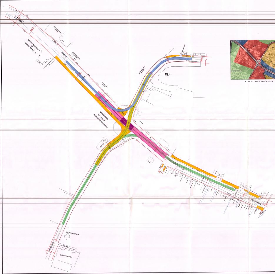
Going by the map, the entire junction is planned to be revamped, with 3 new flyovers (in blue, green and yellow) and 1 underpass (in pink) planned. The orange area (most notably) around IIIT matches the area claimed by GHMC for land acquisition. However, there has been no official confirmation from GHMC regarding the exact area of land being acquired.
Some history
According to Prof. Rajan, the government has shown desires at various points to acquire the land along the road, all for various reasons. Initially, back around 2010, the government wanted to acquire land for building a metro connection, and it is no secret how that ended up. The BRS government also was eyeing the land for an elevated BRTS route. However, this time around, the government is pushing for the road expansion, surprising even Prof. Rajan in their speed of execution.
Next steps
Prof. Rajan emphasized that the college is doing all that they can to ensure the safety and security of the community. As the current main gate stands to be on the chopping block, discussions have started for plans of a new main gate, both during construction and on a long term basis. The Student Parliament is also pushing for the demand to construct pedestrian paths to allow people to cross the roads with ease, to ensure minimal disruption.
We also asked about the buffer between Bakul Nivas and the main road. Prof. Rajan mentioned that they had considered this while planning the design of Bakul Nivas. While even the widened roads will be under legal limits, the institute is considering planting denser and taller vegetation to counter the increased pollution.
What is Ping! doing?
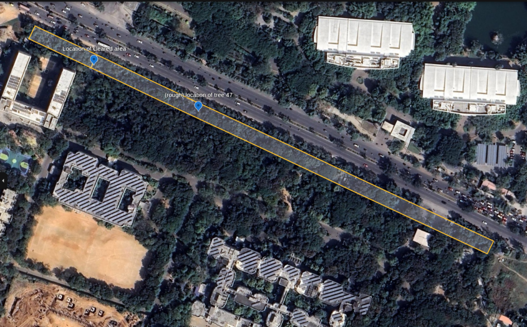
The first order of business was mapping out the area to be acquired. After some struggles with measurement, here is the final map on Google Earth:
In our own independent research (which amounted to scouring various government websites), Ping! could not find any documents in the public domain about the renovation.
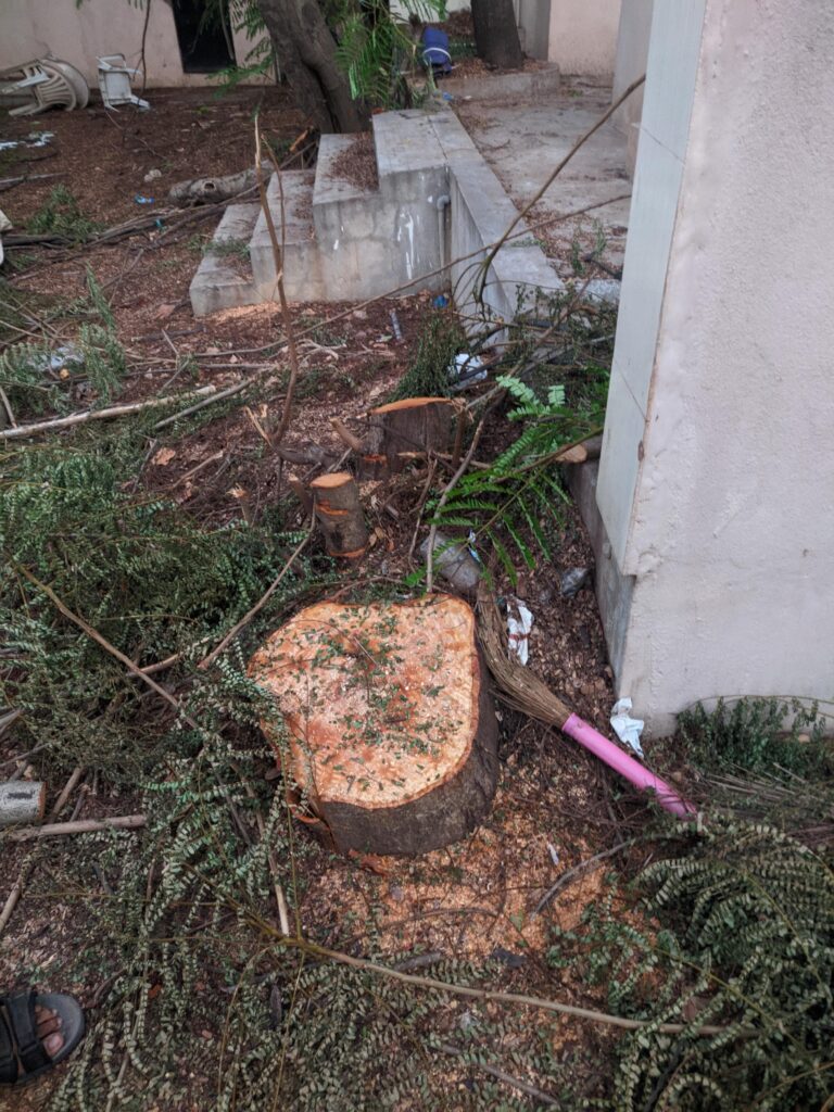
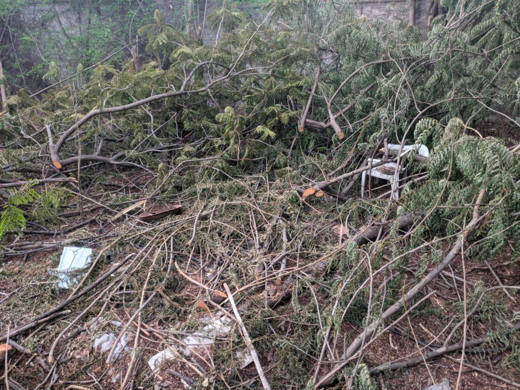
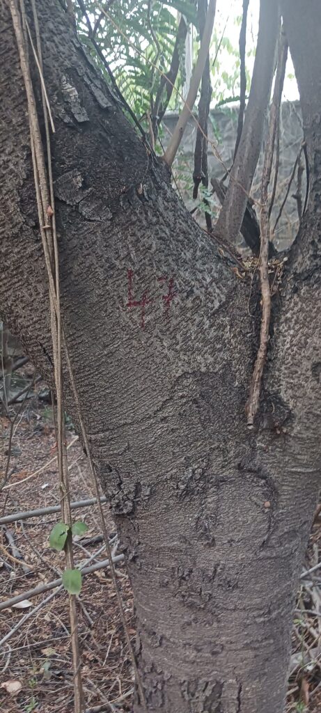
We also took a little walk along the area and were able to spot trees that were numbered. As the numbers were not very high (in the range of 40 to 50), we guess that they are marked for transplantation and not removal. However, we did spot some freshly cut subabool trees. While it is not clear why were they cut, the timing of this, and the manner in which the area was cleared leaves room for suspicion.
We are also filing an RTI with the respective bodies to obtain the relevant documents directing the development of the junction.
Special thanks to Vinay, who has been helping through the entire process.
 Terminal 3
  Parijaat Under Breach
  FSIS coverage – Graduating Batch
  Having Two Homes, Yet Having None.
Great to see Ping bringing up these topics. Kudos!
Thank you for publishing this. Do we know what’s the latest on this topic? Is there a way the general public (not associated with IIIT) can stay abreast with updates?